Cahermaculick
Official Townland name
Civil Parish
Barony
Kilmaine
Poor Law Union
Ballinrobe
County
Mayo
Registrars District
Cong
D.E.D.
Dalgan
439 A. 2 R. 19 P.
O.S. 6" sheet(s)
Mayo 121
Griffiths Valuation
Poor Law Union of Ballinrobe - Page # 137
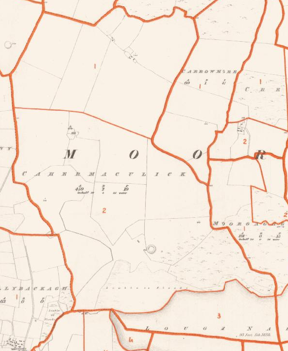
Click on map for a more detailed version

Click on Town Plan for a more detailed version
Click on the Griffiths Valuation Ballinrobe Page # 137 to see a list of tenants with plot numbers to match the Griffith map.
Placenames
Placenames mentioned in this townland are :Field Name Book
Field Name Book description from 1838/1839 noted by the surveyors who produced the O.S maps originally.Cahermakeeleck
B.S.S.M.: 2Cathair Mhic Uillic, Mac Ulick's stone fort.
- Cahermaculick : J. 0'D,
- Cahermaculick : Rev. Jas. Brown, P.P.
- Cahermaculick : Tithe Ledger
This td. is situated in the west side of the parish. It is bounded on the N. and W. by the parish of Kilmainebeg; on the S. by Loughnakill; and on the E. by the tds. of Carrowmore and Moorgagagh. It contains 459a. 2r. 19p., including 50a. 3r. 35p, of water.
It is the property of the Rev. Wm. Crombie, Nenagh . Agent, Charles Crombie Esq., Annefield. It is mostly held by the proprietor as a stock farm; but part is let to one tenant at 24s. per acre yearly. The soil is light, providing good grazing. The only inhabitants in this td. . are 2 herds or caretakers, who are Roman Catholics. There are the remains of an old fort in this td:
When searching for a placename type some or all of the word and click search. If you are unsure of the spelling try a part of the word . For example the placename Mocharra sounds like Moharra so if you search for arra you should find it. For example a placename record ( eg Rostaff ) gives the townland ( eg Moyne ) and the civil parish ( eg Shrule ) .