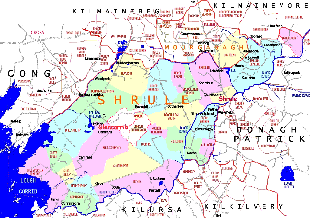
Parish map showing townlands .
Go to the PLACENAMES :: LOGAINM page to see descriptions of placenames in Shrule-Glencorrib parish.
Griffith’s Valuation town plan 1840’s
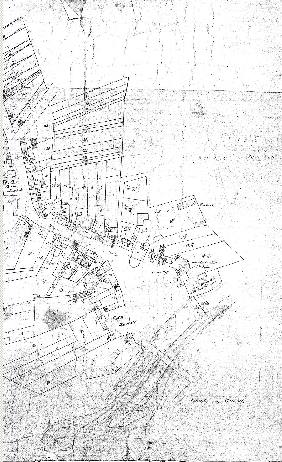
Shrule Town during Griffith’s Valuation (1850)
On Griffith’s Valuation, the numbers and letters of reference to the maps are the connection between the Valuation and the accompanying Ordnance Survey map; they appear on the left of the ‘Number and Letters’ column on the original pages of the Valuation. In general, each townland is surrounded by a thick line on the map, with the numbered subdivisions outlined with lighter lines.
The numbers represent a lot number, that is to say, a single area outlined on the Ordnance Survey map and labeled with that number.
The Bald Map is A map of the Maritime County of Mayo in 25 sheets commenced in 1809 and terminated in 1817 by William Bald F.R.S.E. Printed in 1830 (scale 2 inches)
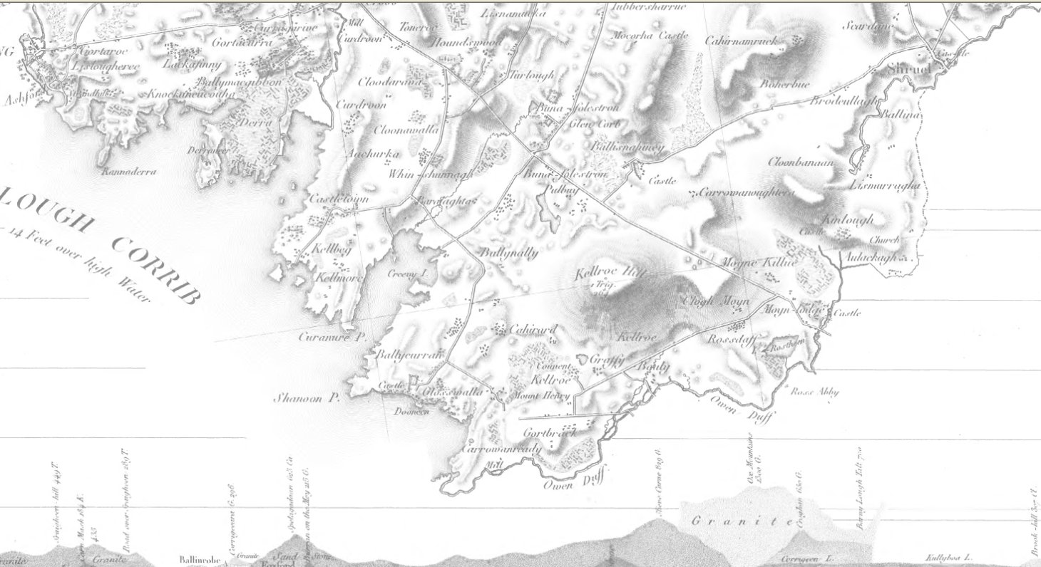
Bald’s map of Shrule (1810)
Available in Mayo County library and online here
After the wars of the mid-seventeenth century, the English government needed solid information on land ownership throughout Ireland to carry out its policy of land redistribution. The Books of Survey and Distribution record ownership before the Cromwellian and Williamite confiscations, c.1641, and after, c.1666 … more info . . .
The Civil Survey (1654) was followed by the Down Survey. William Petty and Benjamin Worsley offered to carry out the mapping exercise with the use of soldiers allocated to their team. The entire island of Ireland was mapped by these crude methods in only 13 months which was a remarkable achievement. Needless to say Petty did not go unrewarded and finished up as a very wealthy landed man.

Petty’s survey map (1654)
The Books for Clare, Galway, Mayo and Roscommon have been published by the Irish Manuscripts Commission. For other counties, manuscript copies are available at the National Library.
Townland
The smallest division, the townland, is the one which has proved most enduring. Loosely related to the ancient Gaelic “Bally betagh”, and to other medieval land divisions such as ploughlands and quarters, townlands can vary enormously in size, from a single acre or less to several thousand acres.
There are more than 64,000 townlands in the country. They were used as the smallest geographical unit in both Tithe Survey and Griffith’s, as well as census returns, and are still in use today. Anything from 5 to 30 townlands may be grouped together to form a civil parish. These are a legacy of the middle ages, pre-dating the formation of counties, and generally coextensive with the parishes of the Established Church, the Church of Ireland.
They are not to be confused with Roman Catholic parishes, which are usually much larger. In turn, civil parishes are collected together in baronies. Originally related to the tribal divisions, the “tuatha”, of Celtic Ireland, these were multiplied and subdivided over the centuries up to their standardization in the 1500s, so that the current names represent a mixture of Gaelic, Anglo-Norman and English influences. A number of baronies, from five in County Leitrim to 22 in County Cork, go to make up the modern county. Baronies and civil parishes are no longer in use as administrative units.
Civil Parish
The parish was the smallest and most numerous unit in the administrative structure of the Catholic church in Ireland, and constituted an area within which a pastor or priest had care of the spiritual needs of the community. Parishes were associated with the monastic and episcopal church organisations and are obviously very old divisions. The Anglo-Normans were familiar with the parochial system and made few alterations apart from rededicating parish churches to universally acknowledged saints. Because of their spiritual associations the early Christian churches were rarely destroyed and their surrounds have been used as burial grounds up to the present. It is possible therefore to identify and map old church sites. The extension of the Reformation to Ireland disrupted the administrative structures of the Irish church. The armed conflicts of the seventeenth century and the suppression of the Catholic clergy further destroyed the continuity which had been maintained since early medieval times.
The old administrative divisions were adopted by the Protestant Church and were used as civil territorial divisions in the land surveys of the seventeenth century. The absence of a Protestant community in the greater part of the country meant that the old parish centres were neglected and failed to attract settlement. That is why today we find striking examples of isolated churches scattered throughout the countryside. Parish boundaries were described in detail in the Civil Survey and Sir William Petty selected the parish as a mapping unit in the later Down Survey. The surviving records of these surveys are important additions to our knowledge of the old parish divisions and their boundaries.
From the Reformation onwards the two major religious communities in Ireland had separate parish structures. The older parishes dating to medieval times and earlier were adopted by the Protestant Church. The Catholic Church, on the other hand, served an impoverished population and had lost its great resources of land and wealth at the Reformation. The great poverty of the population and the difficulty of finding suitable pastors ensured that the new parishes were much greater in size. Population growth in the eighteenth century led to the subdivision of large units. The evolution of the present day parish network of the Catholic church has to be seen in terms of population growth and had little to do with the preReformation parish system. That is why the majority of parish churches date from the early nineteenth century and are primarily located in villages or towns
The civil parish was used in a number of national surveys in the nineteenth century. In the early part of this century cash payments levied on land were substituted for the payment of tithe in kind. Tithe was a payment of a proportion of the produce of arable land made to the Protestant clergy and it was greatly resented as an unjust imposition by the Catholic population. The Tithe Composition Books which date from the 1830’s give details of townland divisions in parishes; the names of townland tenants; the acreage of their holdings and an indication of the quality of the land. Tithe Composition Books do not exist for the whole country. Because they were compiled either on behalf of or by local clergy they vary greatly in respect of information. The surviving parts of the Composition Books may be examined in the Public Records Office, Dublin. Civil parish boundaries were marked in the early Ordnance Survey maps and they were used as Census divisions and as sub-divisions of baronies in the Primary Valuation of Tenements c. 1850